
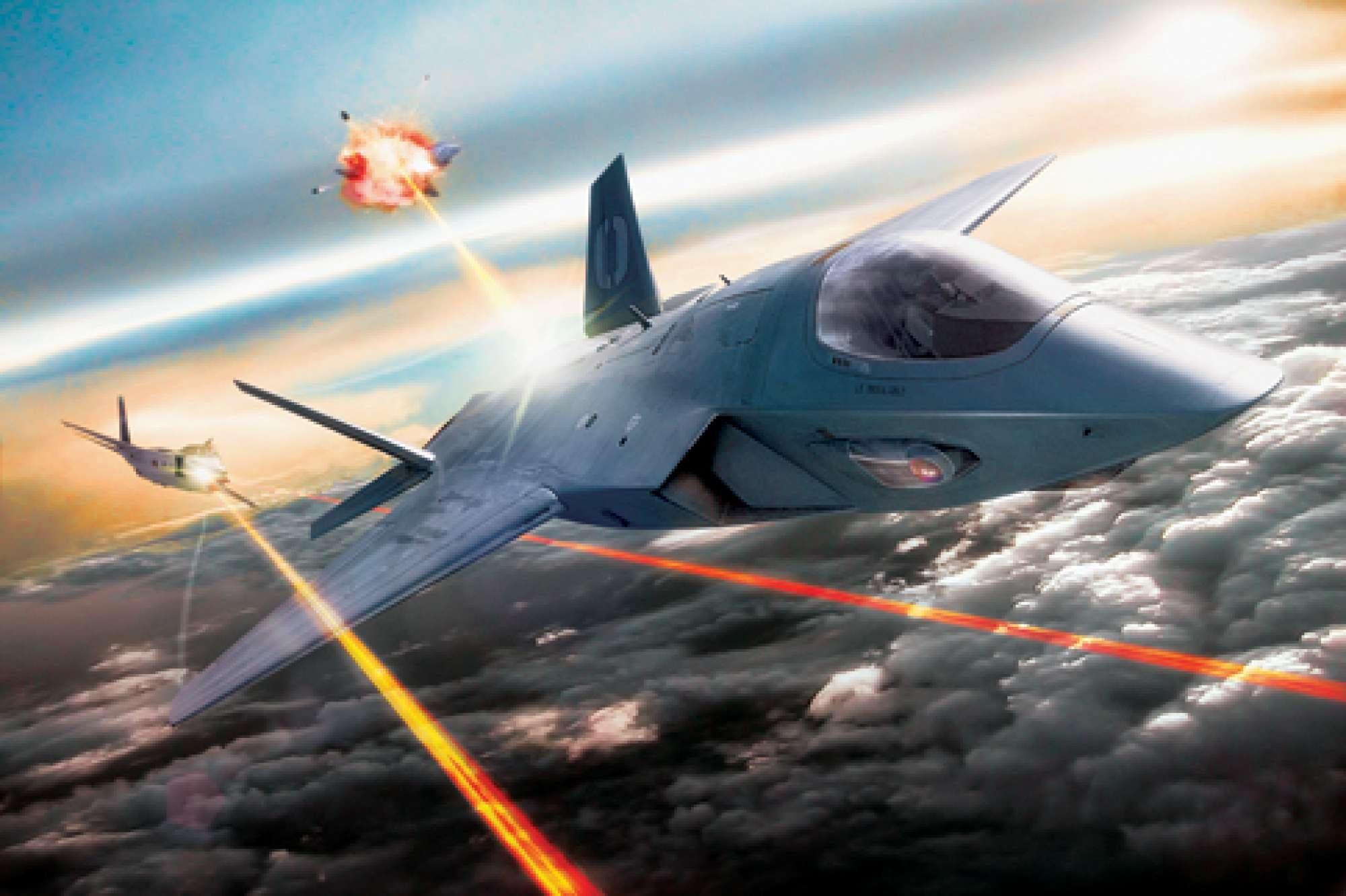
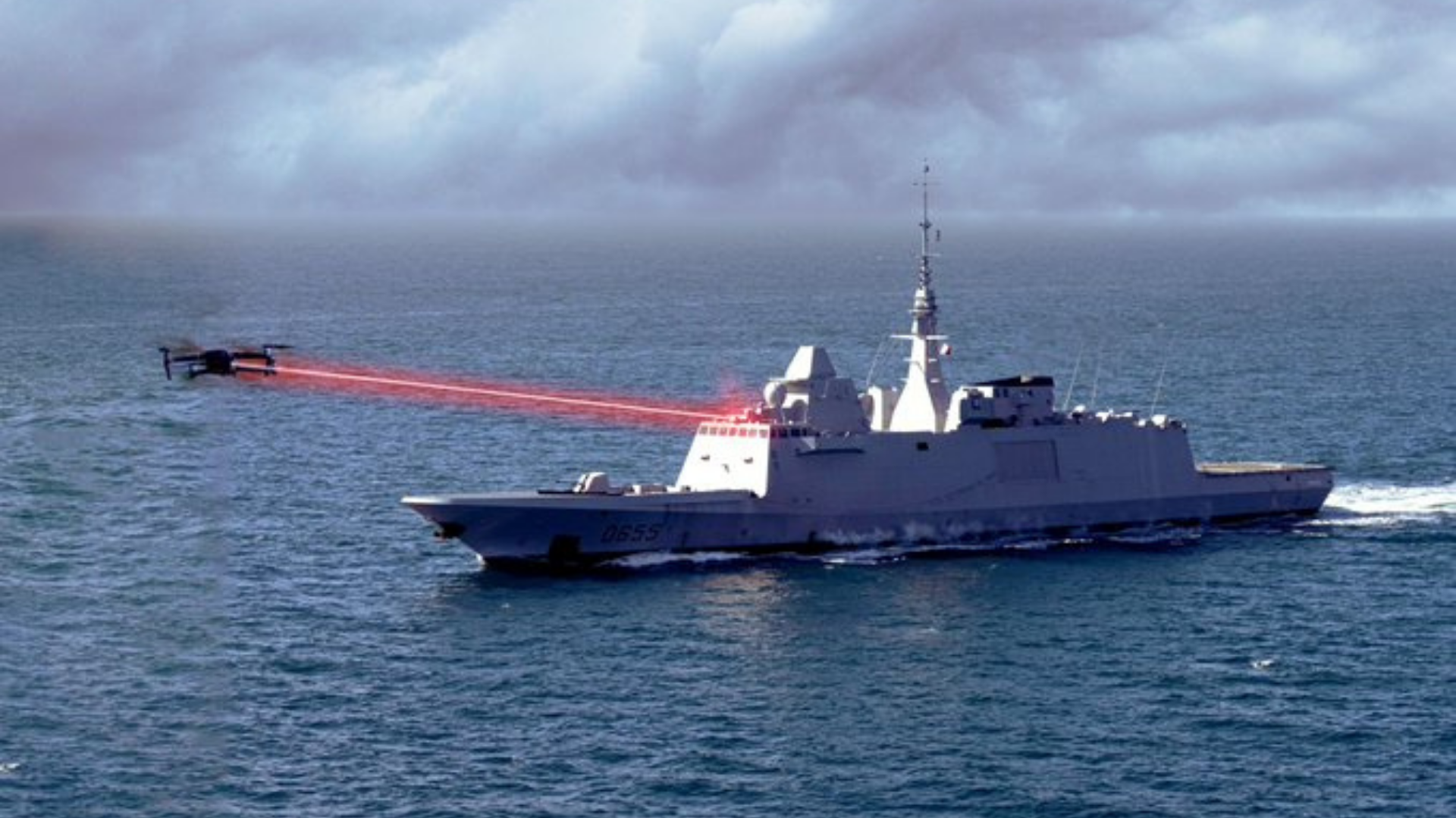
Lead image: Lockheed Martin is developing laser weapons that would be mounted on air, land, and sea platforms and could destroy targets in seconds.
Once the preserve of science fiction, directed-energy weapons could be coming to a battlefield (hopefully not near you) very soon. With many countries around the world currently working hard to make them a reality, it appears we are about to see something of a revolution in arms technology.
Chief amongst such countries is, of course, the United States. But what, if any, directed-energy systems do U.S. Armed Forces have access to? Let’s find out.
What exactly are directed-energy weapons?
As the name suggests, directed-energy weapons (sometimes abbreviated to DEW) are a series of ranged weapons that use highly focussed energy to impact targets, as opposed to firing a solid projectile like more conventional weapons.
The term can also include other weapons that make use of a beam of atomic or subatomic particles.
Like projectile weapons, directed-energy weapons are designed for a range of applications, ranging from anti-personnel weapons to missile countermeasures, anti-vehicular applications, and interference with or destruction of optical devices. In fact, the U.S. Department of Defence (DOD) considers directed-energy weapons like those used “primarily as a direct means to disable, damage or destroy adversary equipment, facilities, and personnel.”
The type of energy used can vary but can include lasers, radio waves, microwaves, or particle beams.
These kinds of weapons have some inherent advantages over projectile-type weapons that include, but are not limited to:
- Directed-energy weapons are generally silent and in some cases invisible. For this reason, they can be used very discreetly. For example, energy outside the visible spectrum is invisible to the naked eye.
- These kinds of weapons are also generally considered to be faster and more flexible than projectile weapon alternatives. Often referred to as a “force multiplier”, directed-energy weapons can, for example, enable a fighter aircraft to counter a range of existing and future threats. Or, indeed, engage multiple targets at the same time.
- Directed energy weapons that make use of light tend to be effectively unaffected by some environmental factors like gravity, wind, etc, This means they can be fired on an almost perfectly flat trajectory. This also makes aiming them more precise and extends their range well beyond the line of sight. However, they also have their own inherent issues. Energy beam weapons will be affected by beam diffraction, absorption, and scattering by the atmosphere over distance, reducing their theoretical range significantly.
- Unlike projectile weapons, which are limited by the physical amount of ammunition available, directed-energy weapons should be able to keep firing as long as they have a power supply. This should, in part, make them cheaper to operate “per shot”, as well as over the lifetime of the system when compared to projectile weapons.
- In the void of space, directed-energy weapons should, theoretically, have a very long-range, and could travel at the speed of light. This would probably prove invaluable for future space combat.
- Generally speaking, the reliability of these systems is entirely dependant on keeping the energy source within safe operating temperatures. This can prove to be technically challenging, as most technologies generate a lot of heat during operation.
- This can be such a problem, that it will often impact the effectiveness and utility of directed-energy weapons in the field. They also require a very stable and reliable power source and are generally restricted in application due to size and weight constraints — especially if mounted on an aircraft or for use as small arms.
- Some types of directed-energy weapons, like laser beams, tend to be severely affected by environmental factors like the presence of water vapor, dust, or other airborne particles. Other energy sources, like radio waves, can also suffer from the inherent issue of radio wave energy being readily absorbed by any conductive material between the weapon and its target.
All well and good, but directed-energy weapons are not without their own unique disadvantages. Directed-energy weapons should be viewed as one facet of a broader revolution in military tech around the world. Much like digital technology has improved the pace and precision of information flows, so to will directed-energy weapons dramatically change how targets are acquired and engaged in years to come.
From current solutions built to engage airborne targets like missiles or drones, the future of this technology could have near endless possibilities once the technical challenges highlighted above are addressed.
Over the long run, many experts in the field strongly believe that directed-energy weapons will open up entirely new types of both lethal and nonlethal solutions. However, this will be entirely dependent on what is deemed “legal”.
Since directed-energy weapons are relatively new, there are few legal constraints on their development and use. This will likely change over the years, which will likely restrict some avenues of development.
For example, under the “Protocol on Blinding Laser Weapons,” agreed by the United Nations in 1995, all signatory nations have agreed to never develop offensive laser weapons that can cause permanent blindness to combatants or civilians. Other international laws also aim to prevent the development of weapons that cause unnecessary harm or cruelty to human beings during combat.
It is highly likely that these laws will be amended, or new provisions will be agreed upon, as new and more potent directed-energy weapons become commonplace.
However, such laws are only good as long as nation-states adhere to them. For example, after the horrors of the First World War, a number of international conventions were put in place to limit the size of armed forces, ship sizes, etc., but this did not prevent the outbreak or limit the scope of World War II. Despite the prescriptive restrictions treaties such as the Treaty of Versailles, Germany still pressed ahead with massive rearmament just prior to the outbreak of the Second World War.
Are directed-energy weapons a real thing?
Any fan of sci-fi will be all too familiar with the concept of directed-energy weapons. From laser cannons on starfighters to the iconic lightsaber wielded by the Jedi and Sith, forms of energy-based weapons are the bread and butter of the genre.
But, as we all know, these are simply pure fantasy. Especially the use of the term “laser cannon” and the special effects we see on the big screen. In most cases, this is something of a misnomer, as these sorts of weapons would probably be closer to some form of plasma-based weapon (more on that later).

But, as it turns out, there are quite a few real-life examples of directed-energy weapons currently in operation or under development. While not as impressive as those seen in the cinema, these weapons are still very powerful and impressive pieces of engineering.
Interestingly, and if historical accounts are to be believed, directed-energy weapons of a kind are actually nothing new. The most famous example is the semi-apocryphal account of the “Mirrors of Archimedes”.
The story goes that the legendary engineer Archimedes of Syracuse installed an array of mirrors with adjustable focal lengths around the defensive walls of the city. These “weapons” were used to focus sunlight on ships of an invading Roman fleet, thereby setting them on fire. We can never really know if this is true, but this sort of application would certainly fall under the definition of directed-energy weapons.
There are other rumors of a weapon known as the “Schallkanone” developed by the Germans in WW2. Allegedly, this “sonic cannon”, was able to generate sound waves that could be targeted at enemy troops at distances of around 220 yards (200m) to 440 yards (400m). While not fatal, the weapon was able to artificially stimulate a victim’s inner ear and cochlear fluid to generate feelings of vertigo and nausea.
However, it is important to note that there are few reliable sources on the veracity of such claims or on the actual existence of this weapon — much like many of the “wonder weapons” supposedly developed by the Germans during the Second World War.
Since then, various attempts have been explored to develop and use directed-energy weapons, most notably U.S. President Ronald Reagan’s Strategic Defense Initiative (SDI) project, aka “Star Wars”, in the 1980s. This system, while never developed, envisaged using space-based lasers or concentrated X-rays to prematurely detonate intercontinental ballistic missiles in flight.
One of the earliest known uses of operational directed-energy weapons occurred during the Iraq War. Electromagnetic weapons using high-power microwaves were used by U.S. forces to destroy or disable Iraqi electronics. There are also rumors other systems may have been used for crowd control.
The latter was probably a form of sonic weapon specially designed for such a purpose. One known example is the Long Range Acoustic Device (LRAD). Developed by the LRAD Corporation, these “sound cannon” systems can be used either as conventional public address speaker systems or to generate extremely loud high-frequency sounds intended to disperse crowds by causing pain, disorientation, and even injury.
Various private and public organizations are developing these kinds of weapons, with one notable example being Lockheed Martin. They have successfully developed a series of offensive, directed-energy weapons that operate using radio frequencies, as well as systems designed as countermeasure systems for ground, sea, and air military assets.
Could we ever build a real plasma gun?
Since directed-energy weapons are actually a thing, you can be forgiven for getting excited about the prospect of potentially developing real-life sci-fi firearms, like plasma guns or Star Trek’s phasers.
Could these in fact become a reality?
Functional plasma weapons, as opposed to lasers, would likely fire bolts, beams, or streams of a highly energetic “soup” of high-energy electrons and ions over distance. Plasma, you will recall, is the fourth state of matter, conventionally generated by superheating gases to cause atoms to ionize, creating ions and free electrons.
Being hit with such a blob of plasma would likely really ruin your day (but probably not kill you), but, as yet, developing a means of generating and then projecting plasma balls or bolts over distance has not been developed. The main problem is that as soon as the plasma interacts with an atmosphere, or even in a vacuum, it quickly dissipates.
For this reason, there have been no successful applications of “true” plasma weapons in the sci-fi meaning of the word. But that doesn’t mean plasma as a directed-energy weapon option is out of the question.
For example, one early plasma-based direct energy weapon was called MARAUDER (Magnetically Accelerated Ring to Achieve Ultra-high Directed-Energy and Radiation). Effectively a type of railgun, this device was shown to be able to accelerate a toroid (donut-shape) of plasma at a very high speed.
This proved highly successful during the early-1990s, but, tantalizingly, scant information has been released about the project’s progress since the mid-1990s.
From what we do know, this device consumed a lot of power and was a pretty heavy piece of tech. It would have little utility outside of being mounted on a ship or very large weapons platform. At present, the ability to miniaturize the technology so it could be mounted on an aircraft, or be held by a soldier, is beyond our capability.
As far as we know…
What directed-energy weapons does the U.S. have?
We’ve already mentioned a few above, but the U.S. armed forces are currently developing various systems to future-proof many of their air, land, and sea assets. Here are some more examples of the most interesting directed-energy weapons that we know are currently being tested or deployed by the United States Armed Forces.
This list is not exhaustive and is in no particular order.
1. Feel the wrath of THOR.
One interesting example, among many, is the U.S. Air Force’s Tactical High-power Operational Responder (THOR). Developed by the Armed Forces Research Laboratory (AFRL), this device uses concentrated microwaves to deal death to airborne targets, notably drones.
The system uses powerful radio wave bursts to disable and effectively knock its targets out of action. It is also designed to be highly portable, with the current iteration able to fit inside a 20-foot (6.1m) shipping container.
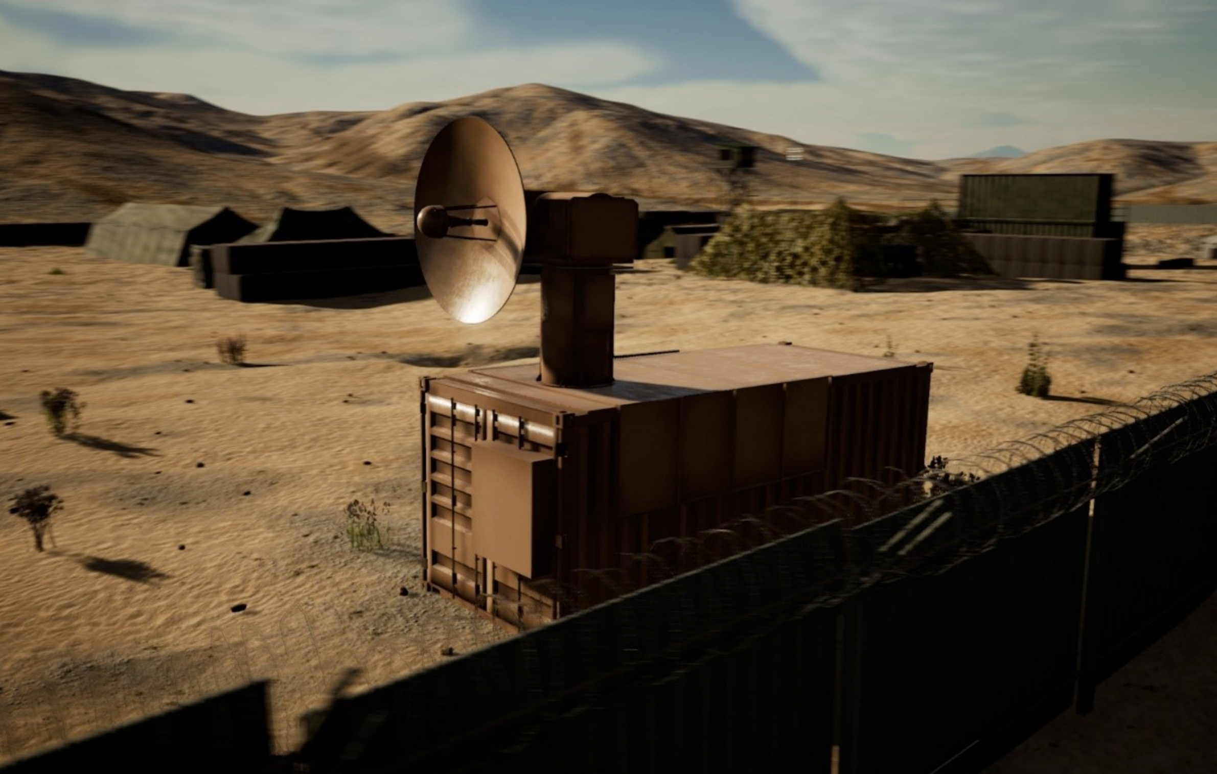
The need for such a weapon is becoming increasingly important, as unmanned aerial vehicles and other drones are set to become a larger part of many combined arms forces in the future.
THOR is able to systematically target and destroy targets at a distance, and in complete silence. The system is still very much in the prototype stage, but it is hoped that THOR will be able to knock out swarms of drones in short order when fully developed.
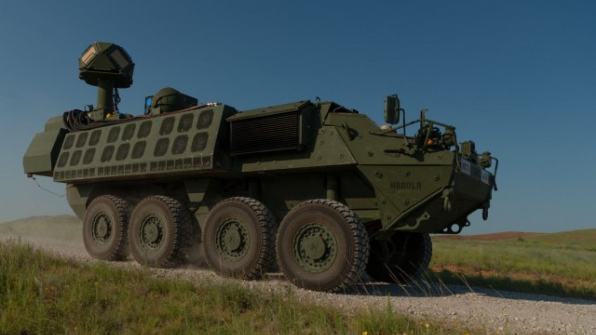
2. DE M-SHORAD can take out missiles, shells, and mortars
With regards to laser-based directed-energy weapons, the U.S. Army has also recently finished testing its new Directed Energy-Maneuver Short-Range Air Defense (DE M-SHORAD). Although designed as an anti-drone weapon, DE M-SHORAD is also capable of intercepting rockets, artillery shells, and mortars.
Also designed as a primarily ground-based anti-drone weapon system, DE M-SHORAD is one very promising directed-energy system currently under development by the U.S.
The recent test of the system was part of a joint exercise between the Army Rapid Capabilities, Critical Technologies Office (RCCTO), Air and Missile Defense Cross-Functional Team, and Fires Center of Excellence. During the exercise, from what information the U.S. Army released, the system was tested in many realistic combat scenarios and included training soldiers in immersive technologies to help familiarize themselves with it.
“This is the first combat application of lasers for a maneuver element in the Army,” said LTG L. Neil Thurgood, Director for Hypersonics, Directed Energy, Space, and Rapid Acquisition. “The technology we have today is ready. This is a gateway to the future.”
Like other directed-energy systems already mentioned, the DE M-SHORAD is designed to shoot down rockets, artillery shells, and mortars mid-flight. Four systems are scheduled to be delivered over the next year or so.
3. LWSD is designed to take out drones at sea
Other nations around the world are also developing their own directed-energy weapons. France, and Israel for example, are both planning on installing laser directed-energy weapons systems to their surface fleet for air defense.
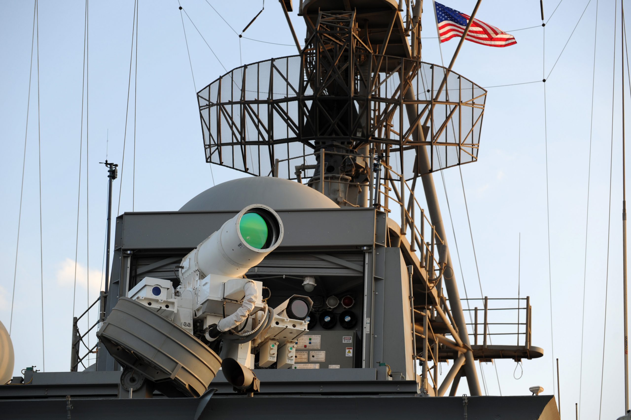
While this might sound fantastical, it was only a few months ago that the U.S. Navy demonstrated their Technology Maturation Laser Weapon System Demonstrator (LWSD) against an unmanned aerial vehicle (UAV).

Mounted on board the USS Portland (LPD-27), this solid-state laser weapon was able to down a UAV. In fact, the U.S. Navy appears to be going all-in with directed-energy weapons.
4. ODIN can dazzle drones
More recent news has revealed further testing of a non-drone killing type of directed-energy weapon called Optical Dazzling Interdictor, Navy (ODIN). This system has been designed to dazzle and confuse drones rather than knock them out of action.
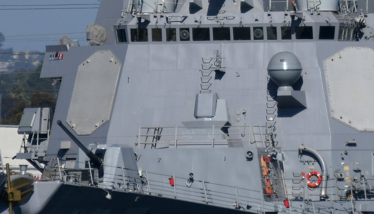
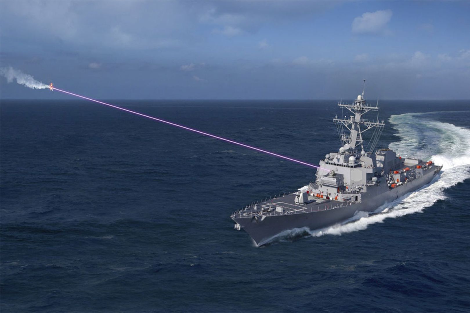
Currently installed on several Arleigh Burke-class guided-missile destroyers, ODIN is part of a package of directed-energy systems currently under development by Lockheed Martin as part of its High Energy Laser and Integrated Optical-dazzler and Surveillance (HELIOS) program.
HELIOS, it is hoped, will be able to fully protect a ship from various airborne threats like drones, and more importantly, anti-ship missiles.
5. The U.S. actually has, well had, a working railgun
While not technically speaking a directed-energy weapon, the U.S. has also come a long way in developing a fully functional railgun. Using directed electromagnetic energy, these weapons are able to launch a projectile at hypersonic speeds, over great distances, with very high accuracy.
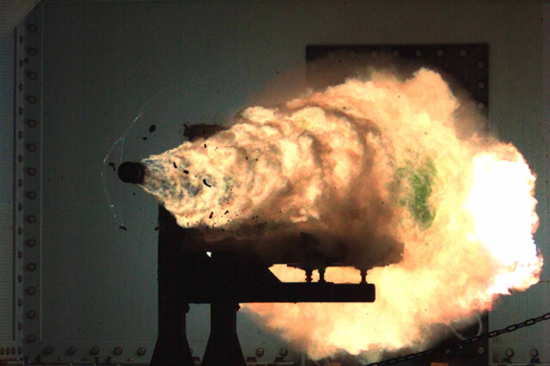
After years of research and around $500 million spent, it was recently announced that all research into railguns for the U.S. Navy has now been mothballed. This decision is partly owing to U.S. officials turning their attention to the development of hypersonic missiles instead.
6. SHiELD-ing aircraft from airborne threats
Another interesting directed-energy system in development by the U.S. Armed forces is called Self-Protect High Energy Laser Demonstrator (SHiELD). Developed by Lockheed Martin and Northrup Grumman, this laser-based directed-energy system is being developed as a fighter jet-based countermeasure against air-to-air and surface-to-air missiles.

While this sounds very impressive, it does come with some very serious technical issues to overcome. Using directed-energy weapons while traveling at high speeds can cause a series of problems for the beam quality. The main one being the fact an aircraft at speed creates shockwaves in the air and other aero-optical phenomena that would seriously degrade the effectiveness of a directed-energy system.
To help combat this, the U.S. Airforce, with the help of the aerodynamics Branch of the Arnold Engineering Development Complex (AEDC) at Arnold Air Force Base in Tennessee, is currently developing a specialist wind tunnel to test ways to overcome these issues.
“The ability to perform aero-optical tests of directed energy systems in the wind tunnels represents a new test capability for AEDC,” said Dr. Rich Roberts, chief of the Aerodynamics Branch Store Separation Section.
“As more DE systems are developed and integrated onto aircraft, we’ll be able to help with design decisions, creating employment envelopes, defining adjacent weapons load-outs, and other things routinely needed by program offices and manufacturers,” he added.
7. Raytheon’s HEL and HPM systems are pretty promising
Another American defense contractor, Raytheon has also developed their own versions of directed-energy systems for the U.S. Armed forces. Their High Energy Laser Weapon System (HELWS) and Phaser (a high-power microwave weapon) have both proved highly capable of eliminating drones, and other unmanned aerial threats, in recent testing.
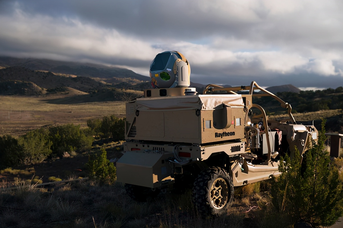
During testing in 2019, the systems proved to be more than able to bring down dozens of remote-controlled drones flying either individually or in swarms.
The “Phaser” system uses microwave energy to disrupt drone guidance systems, effectively rendering them useless. Given a consistent and reliable power supply, such a system could provide near-unlimited protection.
Both Raytheon’s HPM and HEL systems are able to complement one another too. The laser-based system is very effective against individual targets, whereas the microwave system is better at defeating swarms.
And that, future-fans, is your lot for today.
Directed energy weapons have come a long way in recent years and are likely to become more and more numerous and advanced in years to come. Quite how powerful and capable they will become is anyone’s guess, but let’s just hope that lethal anti-personnel versions remain the stuff of science fiction.