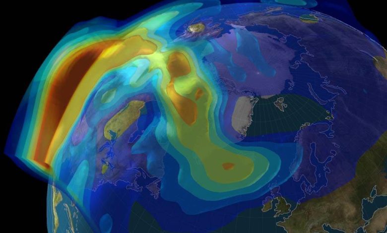
Model of the well-known October 30, 2003, Halloween solar storm produced by the MIDAS tomographic ionospheric model from the University of Bath. Credit: University of Bath
A newly released Android app will turn your smartphone into an instrument for crowdsourced science. Leave it by your window each night with your satnav positioning turned on and your phone will record small variations in satellite signals, gathering data for machine learning analysis of meteorology and space weather patterns.
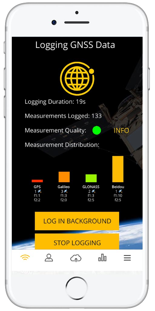
The CAMALIOT app, developed through ESA’s Navigation Innovation and Support Program (NAVISP) with the support of the Agency’s GNSS Science Support Center, is suitable for more than 50 models in the smartphone market which come equipped with dual frequency satnav receivers.
As well as helping to create new Earth and space weather forecasting models, participants are also in with the chance to win prizes including new phones and Amazon vouchers. This four-month ‘citizen science’ campaign runs until the end of July.
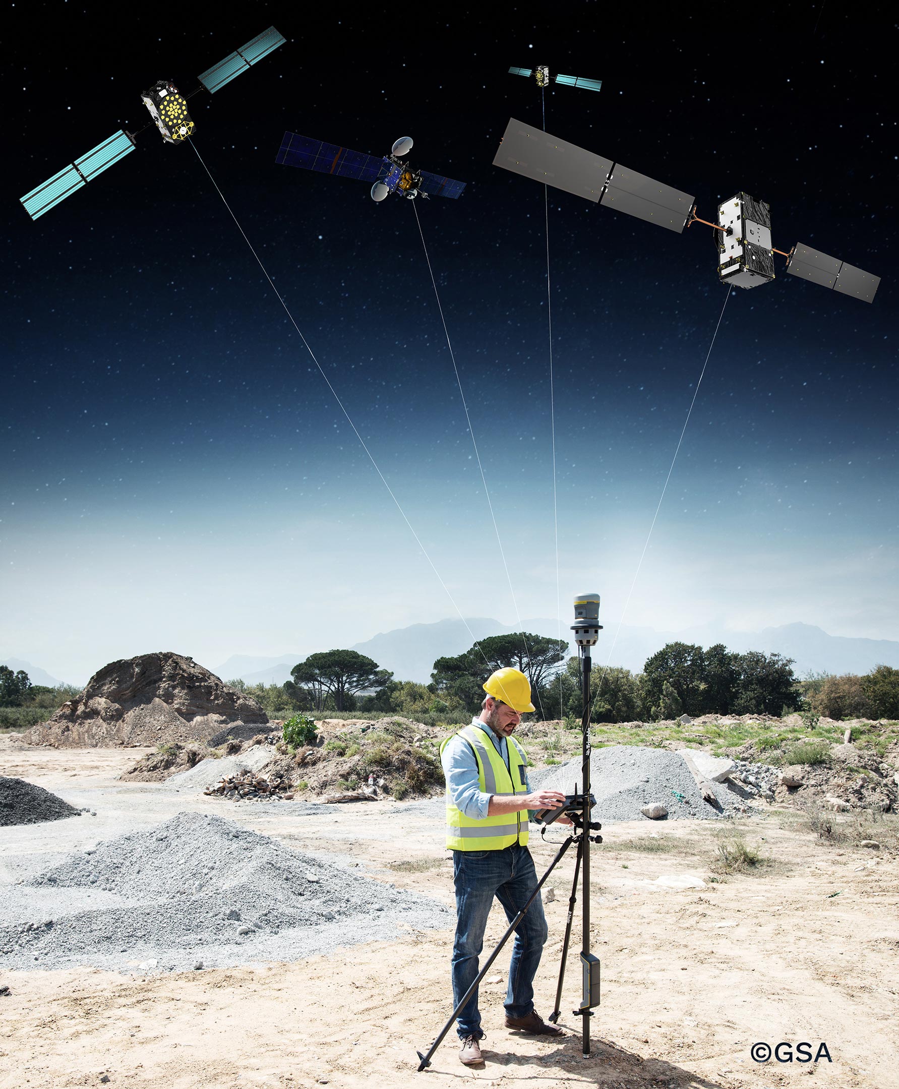
“Global Navigation Satellite Systems such as Europe’s Galileo have revolutionized everyday life,” explains ESA navigation engineer Vicente Navarro.
“And the precisely modulated signals continuously generated by the dozens of GNSS satellites in orbit are also proving a valuable resource for science, increasingly employed to study Earth’s atmosphere, oceans, and surface environments. Our GNSS Science Support Centre was created to help support this trend.”
For instance, tens of thousands of permanent GNSS stations are continuously recording satnav data. As the satellite signals travel down to Earth they are modified by the amount of water vapor in the lower atmosphere, helping to forecast rainfall in particular.
Satnav signals also undergo delay and fading – known as ‘’scintillation’ – as they pass through irregular plasma patches in the ionosphere. This electrically charged upper atmospheric layer is continuously changing, influenced by solar activity, geomagnetic conditions, and the local time of day. Dual frequency satnav receivers can compensate for this effect by comparing their two frequencies.
Vicente adds: “The combination of Galileo dual band smartphone receivers and Android’s support for raw GNSS data recording is what opened up the prospect of supplementing data from these fixed GNSS stations with tens of millions of smartphones, vastly increasing our density of coverage. We took inspiration from the famous ‘SETI@home’ initiative, where home laptops help seek out signs of extraterrestrial life.”
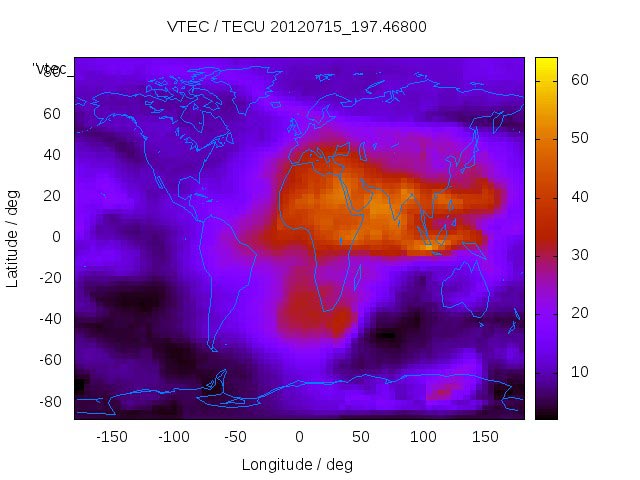
The results can then undergo a ‘Big Data’ machine learning approach, seeking out previously unseen patterns in both Earth and space weather.
Vicente explains: “This is our first step in enlarging GNSS data acquisition using an ‘Internet of Things’ data fusion approach, employing novel sources such as fixed sensors and drones as well as smartphones. A wide range of other applications are also possible for the system, including improving the performance of GNSS systems.”
Formally known as the ‘Application of Machine Learning Technology for GNSS IoT Data Fusion’ project, CAMALIOT is run by a consortium led by ETH Zurich (ETHZ) in collaboration with the International Institute for Applied Systems Analysis (IIASA).
“The CAMALIOT effort was underpinned by Element 1 of our NAVISP research program, spurring innovation in satellite navigation,” comments Pierluigi Mancini, ESA’s NAVISP program manager.
About NAVISP
Many of the experts that designed and oversaw the Galileo satnav system are now supporting cutting-edge European companies in the development of new navigation technologies and services. The result is ESA’s Navigation Innovation and Support Program, NAVISP.

NAVISP is looking into all kinds of clever ideas about the future of navigation: ways to improve satellite navigation, alternative positioning systems and, new navigation services and applications.
Working in partnership with European industry and researchers, more than 200 NAVISP projects have been initiated so far.
Many of the experts that designed and oversaw the Galileo satnav system are now supporting cutting-edge European companies in the development of new navigation technologies and services. The result is ESA’s Navigation Innovation and Support Program, NAVISP.

